
LumoSpot finds bars, cafes, and restaurants with outdoor seating that are in direct sunlight right now, or in the future.
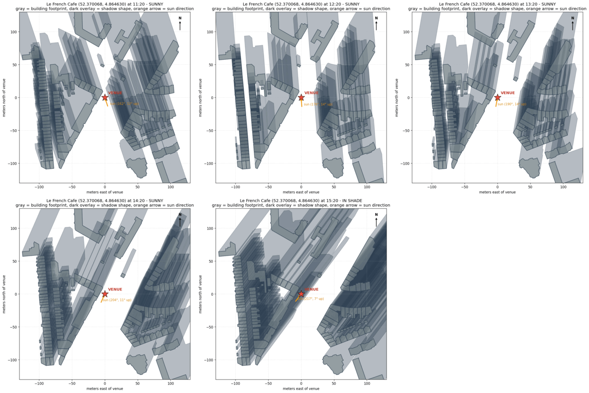
LumoSpot calculates for every registered venue the shadows casted by their surroundings for each time of the day. For that, two things are combined: precise sun position and constructions around each venue. Together these let LumoSpot calculate whether a building nearby would cast a shadow over a specific seating area at a specific time of the day.
To know whether a venue is shaded, LumoSpot checks all buildings within 100m radius of that venue.
Shadow geometry only answers "would the sun reach this spot if the sky were clear" - it says nothing about whether the sky actually is clear. To get this answer, LumoSpot layers a real weather forecast on top: cloud cover and rain refine a geometrically-sunny moment into sunny, partially sunny, cloudy, or rainy. A shaded venue stays shaded regardless of the forecast - weather can only refine an already-sunny result. The "Include weather" toggle lets you switch this refinement on or off entirely, falling back to pure shade geometry when it's off.
Remaining is how much qualifying sun a venue has left today, counted from right now, or whatever time you're viewing, until the end of the day. Total is the full amount for the whole day, regardless of what time it is. Both respect the "Include weather" toggle - with it on, only sunny/partly-cloudy time counts; with it off, any unshaded time counts, whether the forecast is clear or not.
Building heights and footprints come from an open dataset. Weather forecasts come from Open-Meteo. Venue locations and outdoor-seating information come from OpenStreetMap.
Sun times are only as good as the building heights behind them. Where a precise, measured building model exists, the shadows match reality closely, and those venues carry no mark. Elsewhere, building heights come from OpenStreetMap, mapped by volunteers, and a venue there carries one of two marks.
Most buildings around the terrace have a height or number of floors in OpenStreetMap. Each of those heights could be a floor off, so its shadow could reach a little further, or stop a little shorter: the hatched edge. Where that edge crosses the terrace, the sun times can be a few minutes out.
Many buildings nearby have no height in OpenStreetMap at all, so LumoSpot assumes a typical low-rise height of about two floors. A taller building could reach much further: the hatched shadows grow, and so does the part of the day that could go either way. Treat these sun times as a rough indication.
Is a terrace sunnier or shadier than LumoSpot says? Use "Report an issue" on its card.